|
|
|
| WEBGlis | EARTH EXPLORER | NAPP |
You Can Do Remote Sensing
Tutorial
Remote Sensing Basics
If you are looking for pictures instead of data sets, check out the NASA's Image Gallery.
Virtual Atlas of the Moon Free software for Moon observation
Virtual Moon Maps
An Exhibit of Rare Books and Maps from the Collection of the Linda Hall Library.More like this
North Dover
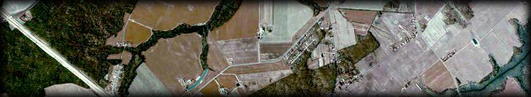
Delaware
from 20,000 feet!
Calverton![]()
(Click on the image for a closeup of my neighborhood)
![]()
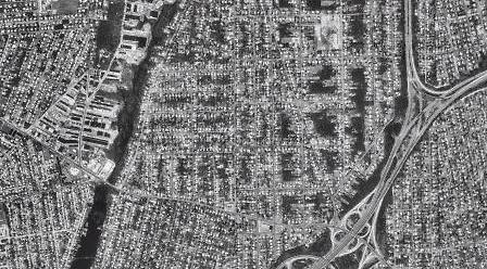
![]() I recently lost myself in New York's
Central Park.
I recently lost myself in New York's
Central Park.
From there, I clicked eastward almost all the way to the Nassau/Suffolk County Border.
Here are images I've obtained so far:
![]() Bethpage
Bethpage
![]() Massapequa
Massapequa ![]()
166k
(Grumman's airstrip can be seen on the right.)
188k
![]() Mitchell Field
Mitchell Field
![]()
National Cemetary
Check out
Trafficam's views of various sites along the
Long Island Expressway.
"Worlds Largest Parking Lot"
Remote Sensing Archeology Research at NASA
Browser for Earth Observations from the Space Shuttle
A World Wide Web accessible graphical catalog and image browse capability is accessible for searching, at no charge, on the Internet through theWebGLIS
U.S. Geological Survey's
Global Land Information System. (GLIS)
![]()
CORONA
![]()

I can see Lake Ronkonkoma^ in the middle of the image!
Click on the image for the full size 78k version (823 X 107)
![]() Declassified Intelligence Satellite Photographs - DISP
If all else fails -
Search the "old way".
Declassified Intelligence Satellite Photographs - DISP
If all else fails -
Search the "old way".
Dover Map ID#'s

DI00000000011053

DI00000000011054

DI00000000011055

DI00000000011056
![]()
Find YOUR Spot on Earth with Microsoft TerraServer's
Clickable Map
U.S. Census Bureau Tigermap v2.5
![]()
![]() Satellite Maps
Satellite Maps
![]() IMAGENet Map Browser
IMAGENet Map Browser
![]() TerraSOAR Demo
TerraSOAR Demo
![]()
![]() Surface Maps for Meteorology.
Surface Maps for Meteorology.
![]() Weather Maps from the Weather Channel.
Weather Maps from the Weather Channel.
![]()
![]()
![]() Landsat Thematic Mapper Datasets.
Landsat Thematic Mapper Datasets.
Including a Step-by-Step Introduction to
Multispectral Image Processing
![]() The Cartography of Non-Spherical Worlds
The Cartography of Non-Spherical Worlds
![]() Map Collection of the University of Stony Brook, New York.
Map Collection of the University of Stony Brook, New York.
Including some of the first maps of the New World to present.
![]() Map Machine from the National Geographic Society.
Map Machine from the National Geographic Society.
![]() Star Charts from the Hubble Space Telescope.
Star Charts from the Hubble Space Telescope.
![]() Maps and References from the University of Iowa.
Maps and References from the University of Iowa.
![]() There are hundreds of
Geography-related links at
There are hundreds of
Geography-related links at
The University of Western Ontario.
![]() Internet Resources in Maps and Cartography
Internet Resources in Maps and Cartography
from the University of Berkeley, CA.
The Linda Hill Library has an online exhibit celebrating the celestial atlas
My favorite star, Capella is in the constellation Auriga the Herdsman.
![]() Computer Space Imaging from profiles-threat.com.
Computer Space Imaging from profiles-threat.com.
A company that provides security and threat assessment.
beachcam.com *
baycam.com *
communitycam.com
harborcam.com *
shorecam.com *
traintimes.com
trafficam.com
![]()
| New Stuff / Friends / Astronomy |

| Shuttle, MIR / Missions / Satellites / WWWeird |